Photo source: Northern Tzoumerka Municipality
Northern Tzoumerka is set to enhance its tourism offering with the creation of 18 signposted hiking trails totaling approximately 41 kilometers.
The new initiative, part of the “Trails and Hiking Routes of Northern Tzoumerka” project, is funded by the EU’s Recovery and Resilience Fund and combines heritage, recreation, and environmental conservation.
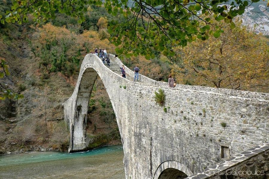
The Tzoumerka mountains, renowned for their unspoiled beauty, waterfalls, and historical landmarks like stone-built churches and bridges, will be at the heart of the new trails network. The project aims to connect both locals and visitors with the rich natural and cultural heritage of Epirus.
Following an adjustment of the original plan to align with the project’s budget of nearly 290,000 euros, the Municipality of Northern Tzoumerka has announced a tender for the contractor selection. The municipality aims to sign the contract by the end of May, with construction set to begin in early summer. Despite budget adjustments, no trails were removed from the project, and the municipality assures that the safety, walkability, and visitor information quality will remain unaffected.
The trail network will span the entire municipality, targeting lesser-known paths in need of restoration and signage. This initiative, combined with already-developed routes, will create a fully maintained, annually monitored network designed to support sustainable tourism and preserve the region’s mountainous environment.
Hiking routes to showcase Epirus’ beauty
Among the new routes are several that lead to remarkable sites, such as:
Pouliana – Kouiasa (1.8 km): A historic path to a traditional watermill once used by the inhabitants of Syrrako and Kalarites.
Kalarites – Agioi Anargyroi – Avatos (3.07 km): Connecting the chapel of Agioi Anargyroi to the ancient site of Avatos, perched dramatically on a cliff.
Kalentzi – Klifki (2.49 km): A riverside route passing waterfalls, springs, and an old watermill, beneath the archaeological site of Kastrí.
Fortosi – Agios Elias – Aidonokoukli – Pateros (4.49 km): Offering panoramic views of the Arachthos River, this trail ends in the village of Pateros.
Enhanced infrastructure for visitors
Each trail will feature clear signage and vital information, including distance, difficulty, and landmarks. Improvements to the paths will include vegetation clearing, surface leveling, and the installation of dry stone walls, wooden steps, and small bridges. Additionally, rest stops, gazebos, and scenic viewpoints will be added to enhance the hiking experience.
Follow GTP Headlines on Google News to keep up to date with all the latest on tourism and travel in Greece.
Source link