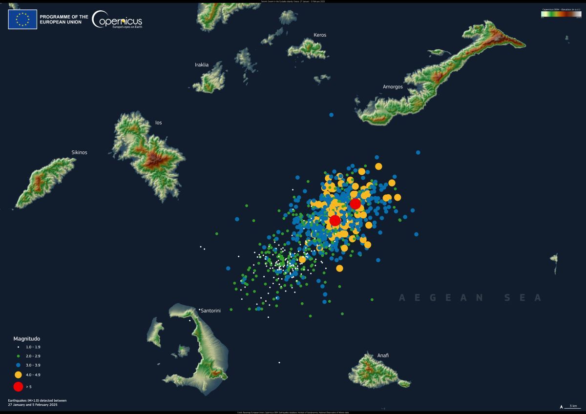

This visualization, created using the Copernicus Digital Elevation Model, illustrates the locations and magnitudes of the earthquakes since the onset of this seismic crisis. Credit: European Union, Copernicus Digital Elevation Model
The Greek government has declared a state of emergency for Santorini after days of sustained seismic activity affecting both the island and nearby Amorgos.
The decision, announced by the Ministry of Climate Crisis and Civil Protection, aims to address the immediate needs and manage the aftermath of the recent seismic events. The state of emergency will remain in effect until March 1, according to the ministry’s statement.
Since January 27, more than 1,000 undersea earthquakes have been recorded in the area, with some exceeding a magnitude of 5.0. The epicenters of the tremors have been primarily located between Santorini and Amorgos.
The continued seismic activity has prompted significant evacuations, with approximately 6,000 people leaving Santorini via planes, boats, and private yachts.
On February 3, emergency response teams were deployed, and local authorities issued safety precautions for residents and visitors. These included draining swimming pools and avoiding areas at risk of rockfalls due to the island’s steep cliffs.
On the night of Wednesday, February 5, six earthquakes with magnitudes greater than 4 were recorded in the waters surrounding Santorini, followed by a more powerful tremor of 5.2 south of Amorgos.

Earthquake sequence in Santorini Island since January 28. Credit: EMSC-CSEM-ORG https://www.emsc-csem.org/Special_reports/?id=351
Follow GTP Headlines on Google News to keep up to date with all the latest on tourism and travel in Greece.
Source link